Hiking
 Classic · VinicuncaUS$ 29
 Red Valley + VinicuncaUS$ 29
Quad · ATV
 Vinicunca quadUS$ 70
Red Valley + quadUS$ 75
Classic · VinicuncaUS$ 29
Red Valley + VinicuncaUS$ 29
Vinicunca quadUS$ 70
Red Valley + quadUS$ 75
Vinicunca quadUS$ 70
Red Valley + quadUS$ 75
Classic · VinicuncaUS$ 29
Red Valley + VinicuncaUS$ 29
Vinicunca quadUS$ 70
Red Valley + quadUS$ 75
Everything the day actually shows you — from the Vilcanota valley and the alpaca pastures to the ridge itself, the Ausangate glacier and the Red Valley.
People book this tour for a single photograph, and then spend the day discovering that the mountain is the last part of a much longer landscape. The drive south follows the Vilcanota valley, the breakfast stop sits in a working farming village, and the road to the trailhead climbs through pasture where alpacas outnumber people. Above it all stands Ausangate at 6,384m, the most sacred peak in this part of the Andes. Here is what the day includes, stop by stop.

The striped ridge itself, with around 40 minutes to an hour at the viewpoint depending on your plan.
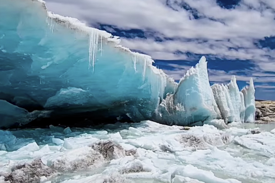
6,384m of ice on the horizon, visible from the ridge and much of the upper trail on clear days.
Working herds along the whole upper route, with families in traditional dress tending them.
Two hours of Andean farmland, terraces and villages on the drive south from Cusco.
Breakfast in Chirihuani at 3,310m, and the buffet lunch stop on the way back.
| Stop | Altitude | What you see |
|---|---|---|
| Vilcanota valley | 3,000–3,400m | Terraced farmland, villages and the Vilcanota river on the drive south |
| Cusipata / Chirihuani | 3,310m | A working highland village, and where breakfast and lunch are served |
| Road to Phulawasipata | up to 4,650m | Open pasture, alpaca and llama herds, herding families |
| Vinicunca trail | 4,650–5,090m | The striped slopes opening up as you climb |
| Vinicunca viewpoint | 5,090m | The ridge itself and the Ausangate glacier opposite |
| Red Valley | above 4,900m | Deep red slopes, optional and self-guided on hiking plans |
Tap a column header to highlight it
💡 Note: the ATV plan covers the same route by quad and reaches the same viewpoint, but does not include the Red Valley.
The obvious ones are the alpacas and llamas, which graze right beside the trail. Look higher and you may spot vizcachas, rabbit-like rodents with long tails, sunning themselves on the rocks, and Andean geese near the streams. Condors are occasionally seen over the ridges, though nobody should book this tour expecting them.
The stripes read best in mid-morning light, when the sun is high enough to reach into the folds but not yet flat. Wide angles flatten the ridge; a moderate zoom from slightly below the main platform gives a better sense of scale, especially with a person in the frame. Bring spare batteries — cold at 5,000m drains them fast.
There are no Inca ruins at Vinicunca, no restaurants at the top and no reliable phone signal on the trail. Local families sell drinks and snacks along the path, in cash. This is a landscape day, not an archaeological one — if you want Inca sites, pair it with the Sacred Valley on another day.
Reserve online in under two minutes — instant confirmation, secure checkout.
Complete your Peru adventure with these expert-guided full day experiences.




"Life is short and the world is vast — the sooner you start exploring it, the better."